

Reviewed by the S Reid Roofing Ltd team — last reviewed 2026-09-15
Quick answer
Yes. Height, multiple roof levels, extensions, chimneys and complex junctions can make ground-level assessment incomplete. Drone photography can capture several elevations before deciding whether physical access is also required, which helps focus any further inspection on the areas that genuinely need it rather than the whole roof by default.
At a glance
- Ground-level views often only show one or two elevations clearly.
- Multiple roof levels and extensions create junctions that are hard to see from below.
- A drone can build a fuller picture before any decision is made about further access.
- Complexity is itself a reason to document rather than guess.
A drone survey documents what is visible: covering condition, flashings, chimneys, gutters and rainwater goods. It cannot see concealed timber decay, hidden membrane or fixing failure, every source of water ingress, or confirm structural adequacy — where those are suspected, a hands-on inspection is recommended alongside the imagery.
Where ground-level assessment falls short
Properties with steep pitches, tall chimneys, multiple roof levels or later extensions often have junctions and slopes that simply cannot be seen properly from the ground, whatever angle is tried. Binoculars help to a point, but they cannot show a valley behind a chimney stack or the far side of a hip roof.
Building a complete picture before deciding next steps
A drone can be flown to capture each slope, junction and detail from a position that would otherwise require significant access equipment just to view. This gives a much fuller picture of the roof's actual condition, which then informs whether physical access is genuinely needed, and if so, where it should be focused rather than covering the whole roof by default.
Junctions are where problems concentrate
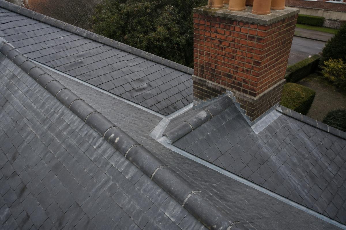
Roofs with more than one level, or with extensions built at different times, tend to have more junctions — abutments, valleys, changes in covering — and it is at these junctions that defects most commonly occur, since they involve more detailing and more potential weak points than a plain, single slope.
A drone can be positioned to look directly at these junctions from angles that ground-level viewing simply cannot achieve, which is exactly where the extra detail is most valuable.
Combining drone imagery with a floor plan of the roof
On genuinely complex properties, it can help to build a simple plan of the roof levels alongside the drone imagery, so that each image is clearly located against the whole. This avoids confusion about which slope or junction a particular photograph relates to once several roof levels are involved.
Recognising when complexity itself is the risk factor
On some properties, the complexity of the roofscape is itself worth flagging as a maintenance consideration, independent of any specific defect, since more junctions generally mean more points that need periodic checking over the life of the roof.
What aerial images cannot tell you on a complex roof
However many angles a drone captures, the resulting images only show the outer surface of the coverings, flashings and trims. On a multi-level roof this matters more than on a simple one, because hidden abutments, valley gutters and the junction between an extension roof and the original structure can look sound from above while the underlying timber, membrane or fixings behind them are already deteriorating. A drone cannot confirm what condition the roof structure or covering is in beneath what the camera can see.
For that reason, on roofs where the imagery identifies several junctions of concern, it is usually worth treating that as a shortlist for hands-on checking rather than a finished assessment, particularly where a junction cannot be viewed from a clear enough angle to judge its detailing with confidence.
What we would check
During an inspection, areas we would normally look at for this include:
- Every distinct roof level and its junctions with the rest of the property.
- Chimneys and their flashings from more than one face.
- Valleys and abutments that are hidden from ground level.
- Whether findings justify targeted physical access, and where.
Roof photography
Related questions
Relevant services
Book a Drone Inspection
High-resolution imagery of the covering, flashings, chimneys and rainwater goods, with documented findings before any work is recommended.